Mount Evans - Idaho Spring Day Trip 2005
- Front Range
- 2002 Report
Summary
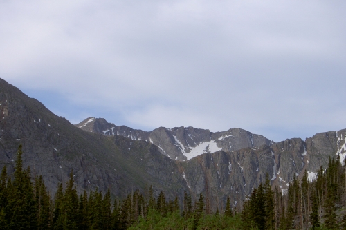
Mount Evans Elevation 14,270ft. (July 5, 2005) "Chicago Creek" trail from Echo Lake TH. From this TH, this class 2 trail runs (15 miles rt. with 4,600ft. gain) including the summit of Mount Spalding (elevation 13,842ft.). TH directions are as follows, take I-70 West to Idaho Springs Exit 240, go 13.4 miles on Colorado 103 South to Echo lake. Park in the parking lot on the West side of the lake in the picnic area. The trail goes along the side of the lake and then down some switch backs down to the Chicago Lakes road. Notice I said down, this means that you get a nice little climb back up to your car on the way out, argh. Once on the road you go South to the Chicago Lakes TH. The route goes up to the Chicago lake and then up the East side of the basin to the notch/saddle between Mt. Warren and Mt Spalding. Through the notch is Summit lake. I went for the loop summit which was the Northeast slopes of Evans and then the ridgeline hike to Mount Spalding and then back down to Summit lake.
Read More Details or View Slideshow
Trip Schedule break down
| Saturday | 6:55AM | -left Echo Lake TH. |
| 9:35AM | -reached the Summit Lake Shelter. | |
| 10:30AM | -summit Mount Evans. | |
| 12:00PM | -summit Mount Spalding. | |
| 12:30PM | -back at the Summit lake saddle.. | |
| 2:55PM | -back at Echo Lake TH. |
The route up to summit lake is pretty well defined but the new trail that runs between upper and lower Chicago lakes requires scrambling over rocks and avoiding a creek and mud. Also the slopes on Mount Warrens West side up to the saddle is in the process of being re-routed by CFI (Colorado Fourteeners Initiative). The new trail goes up the grassy slopes and then does a very long traverse over to the saddle/notch.
Once at summit lake the Northeast face route up Mount Evans starts about a mile up the road. You can walk along the road for a ways until you side rock cairns in the ditch and on the slopes to your right. The Northeast trail is no well defined and just a loose rock scramble up to the Mount Evans parking lot. As always the parking lot was full of tourist and those that drove up the mountain. From the parking lot there is a short hike to the summit which uses some rather long switch backs which are bike-able as well, check out my 2002 mountain bike climb.
From the summit you can follow the ridgeline down to West until you find some large cairns to follow. The cairns are well placed and easy to follow. Once you get to the intersection of "The Sawtooth" trail over to Bierstadt there are more cairns all the way over to Mount Spalding and back down to Summit Lake. I was surprised at how well marked this trail was. Heading back down to Summit Lake via the Spalding loop was much easier then the alternative of down climbing the steep and loose Northeast slopes of Evans.
The rest of the hike was uneventful except for having fun following the newly placed CFI flags on the trail. In the morning CFI had not yet arrived for work, but by the time I was going down they were in full force. First I passed the route planers for CFI and then I passed the volunteer workers carrying pick axes, shoves, and spud bars.